Karst Landscape Characterization
Why it matters • What it is • Mapping lineaments & sinkholes
Why Karst Characterization?
- ~20% of global land surface shows karst features; many aquifers are karstic.
- Rapid, anisotropic flow → flashy recharge, contaminant vulnerability, sinkhole hazards.
- Management needs spatially explicit maps: recharge zones, flow paths, hazard areas.
- Goal: reproducible workflow to identify lineaments & delineate sinkholes and derive metrics (depth, volume, density).


What is “Karst Characterization”?
- Integrated mapping of surface & subsurface indicators:
- Sinkholes (dolines), dry valleys, uvalas, caves/springs
- Lineaments (fractures/joints/faults) guiding groundwater flow
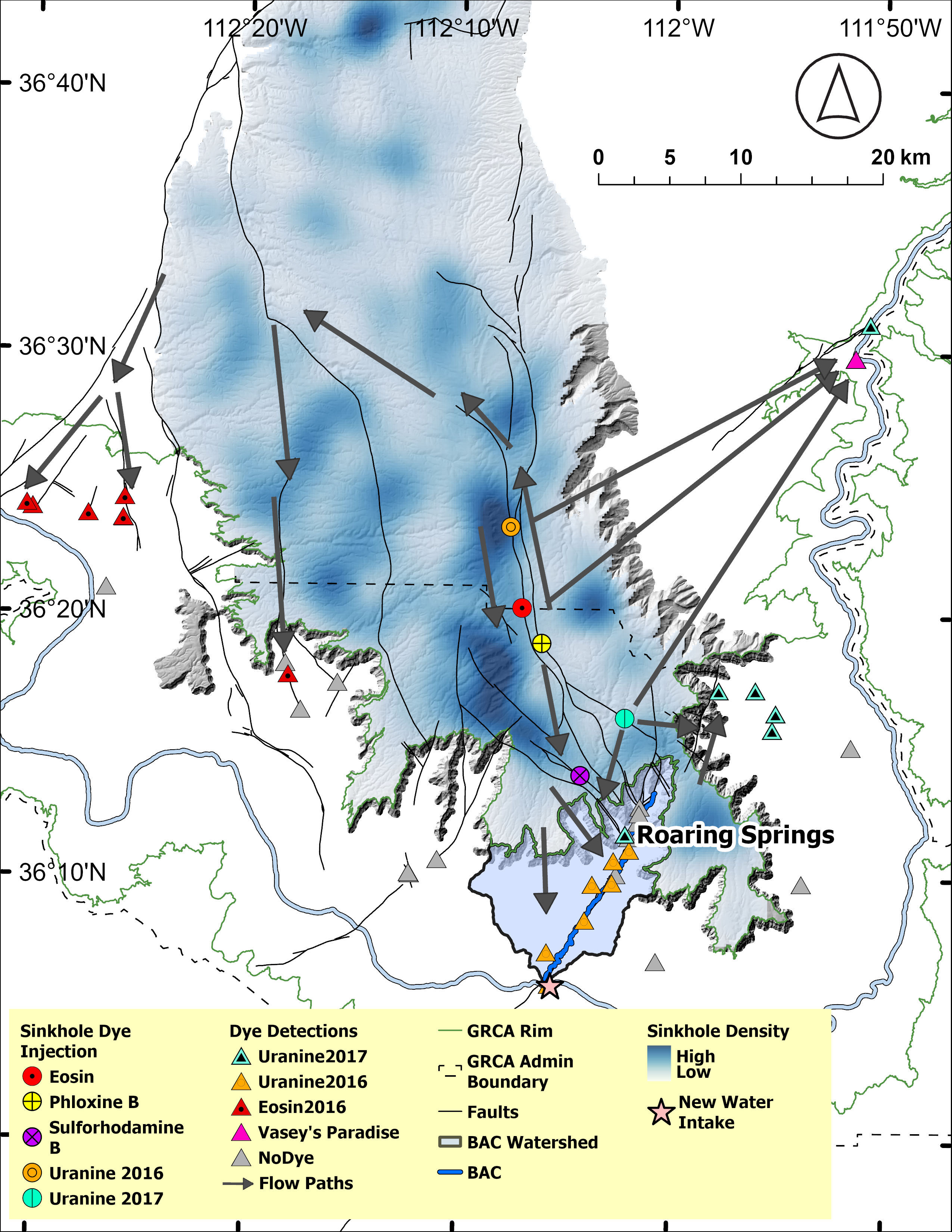
- Dye Traces Identify flowpaths of water from sinks to springs, caves, streams
- Products:
- Inventories (points/polygons/lines), density maps, terrain derivatives
- Suitability/recharge potential layers for decision support
What is “Karst Characterization”?

Datasets
- Elevation: 3DEP (10–30 m) or local LiDAR (≤1 m)
- Imagery: NAIP/Planet/Sentinel-2 (false color helpful)
- Bedrock/Soils: geology units, GLHYMPS, SSURGO
- Hydrography: NHD springs/streams; field GPS
- Optional: UAV-SfM for cm-scale morphology (lecture #2)

 —
—
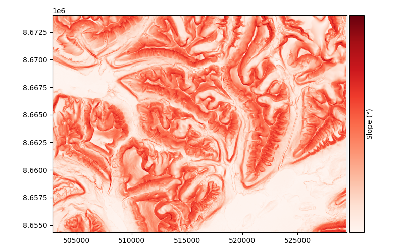
DEM Preprocessing
- Reproject to target CRS (e.g., UTM 12N)
- Fill small artifacts conservatively (avoid erasing true depressions)
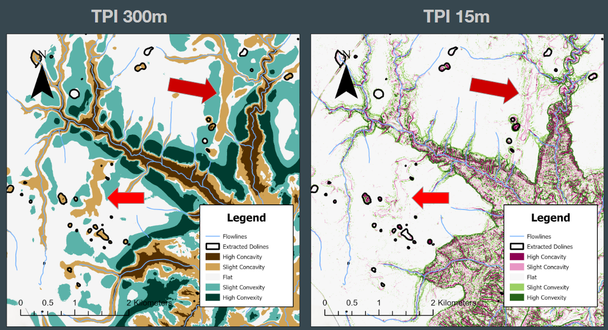
- Derive slope, aspect, curvature, TPI/TRI
- Multi-scale analysis (window sizes tuned to expected sinkhole diameter)
![Terrain Attributes]()
:::
Notes: This is what we did (will do) in the lab exercise ::: —
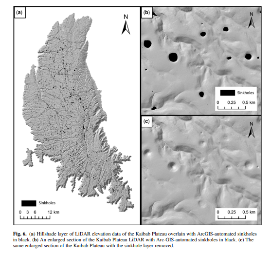
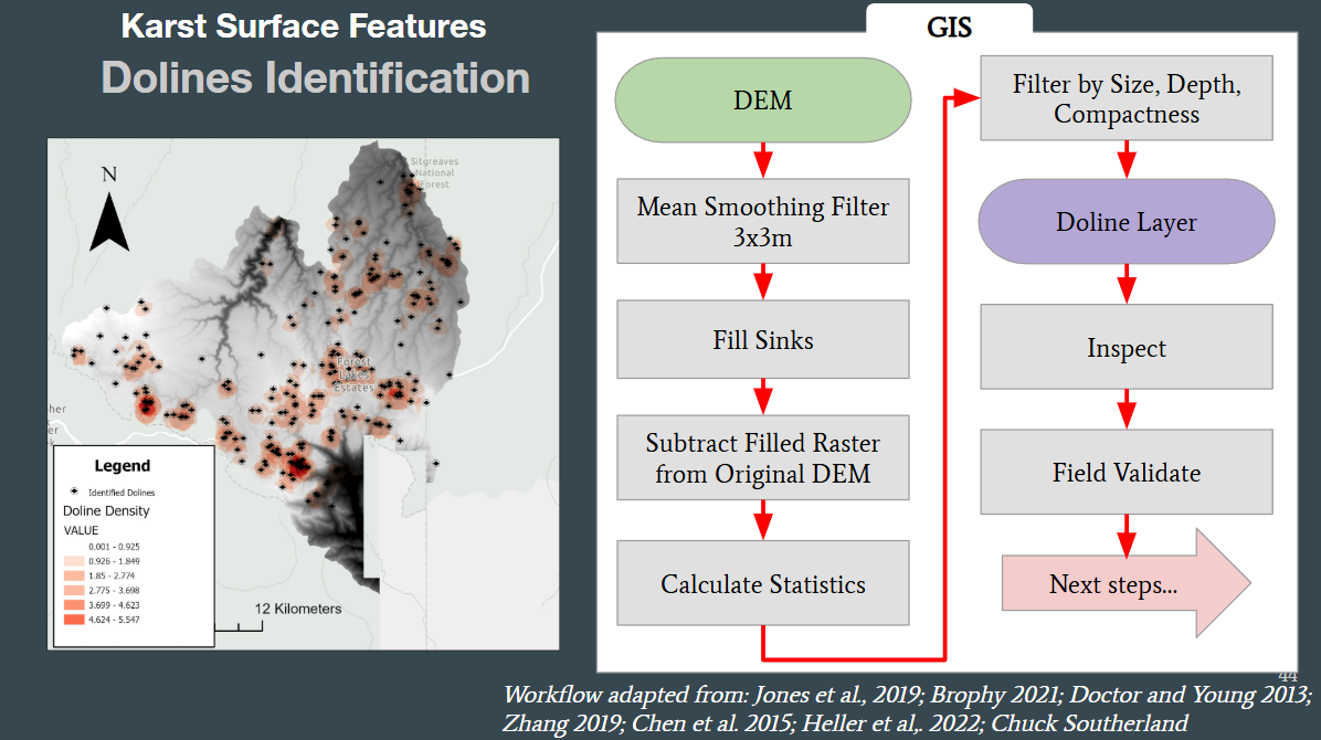
Mapping Sinkholes (Raster-first)
- Closed-depression detection
- DEM fill vs. original → depth raster (Cut/Fill logic)
- Threshold minimum depth & minimum area
- Morphology filters
- TPI/TRI, curvature (concavity), circularity metrics
- Vectorization
- Raster → polygons; clean with dissolve/simplify
- Attributes
- Depth, area, volume, elongation, circularity (4πA/P²)
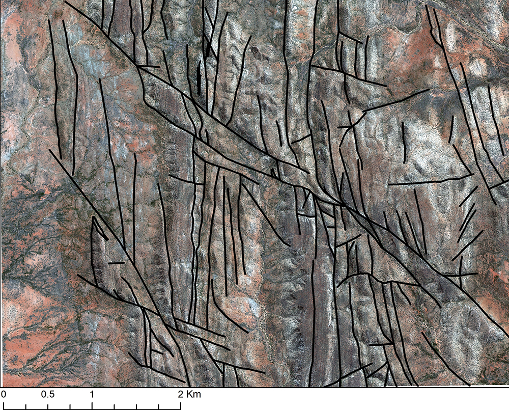
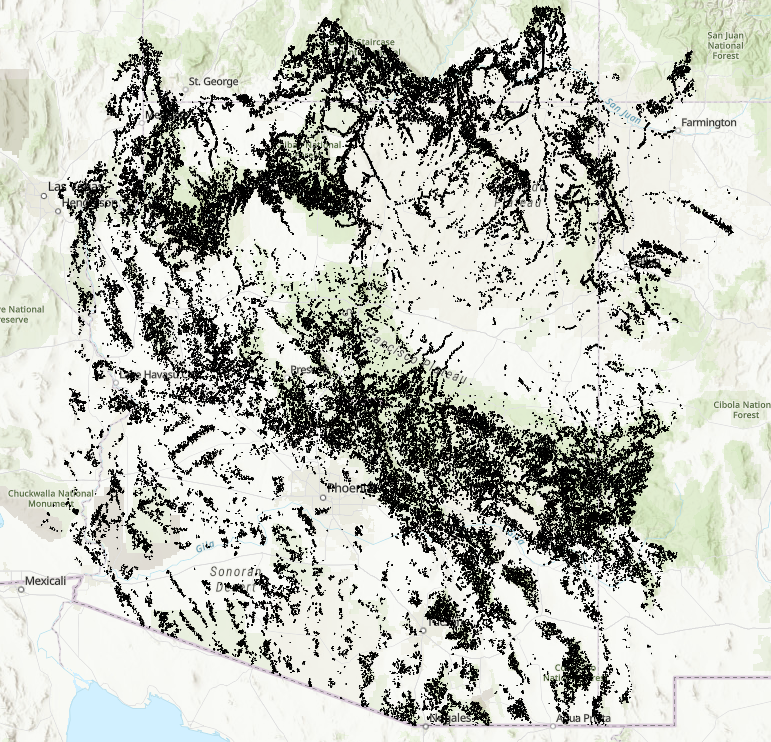
Mapping Lineaments (Raster/Imagery)
DEM-based (shaded relief): - Multi-azimuth hillshades; combine (min/mean) - Edge detection (Canny), non-max suppression - Hough Transform for straight segments; merge/extend with angular tolerance
Optical imagery (optional): - Structural traces in bare or sparse vegetation - PCA/band ratios; NIR enhances lithologic contrasts
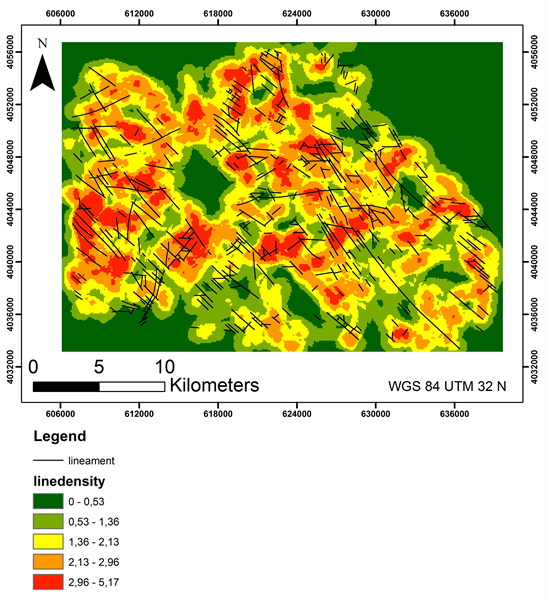
Postprocess: - Snap/merge segments, remove short/noisy lines - Compute orientation (rose diagrams), length density (km/km²)
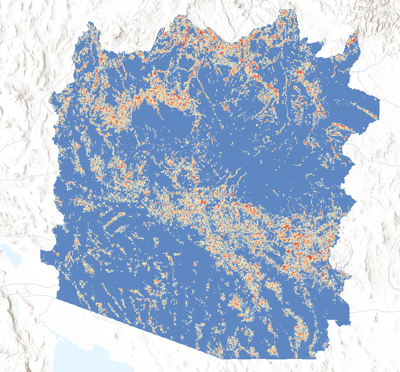
Outputs & End-uses
- Sinkholes: polygon inventory with depth, area, volume, circularity

- Lineaments: polyline set with azimuth, length; density rasters
- Dye Trace: polyline from introduction point to detection point
- Maps: suitability/recharge potential, hazard zones
![]()
Going Further
Once a database of validated sinkholes and lineaments are created:
Utilize the database for training a Deep Learning Model to Identify Sinks

Image Segmentation
Use Terrain attributes as input to DL model.
- increase ability to automate karst landscape Characterization
- identify sinks that are not closed or subtle lineaments (hard for current tools)
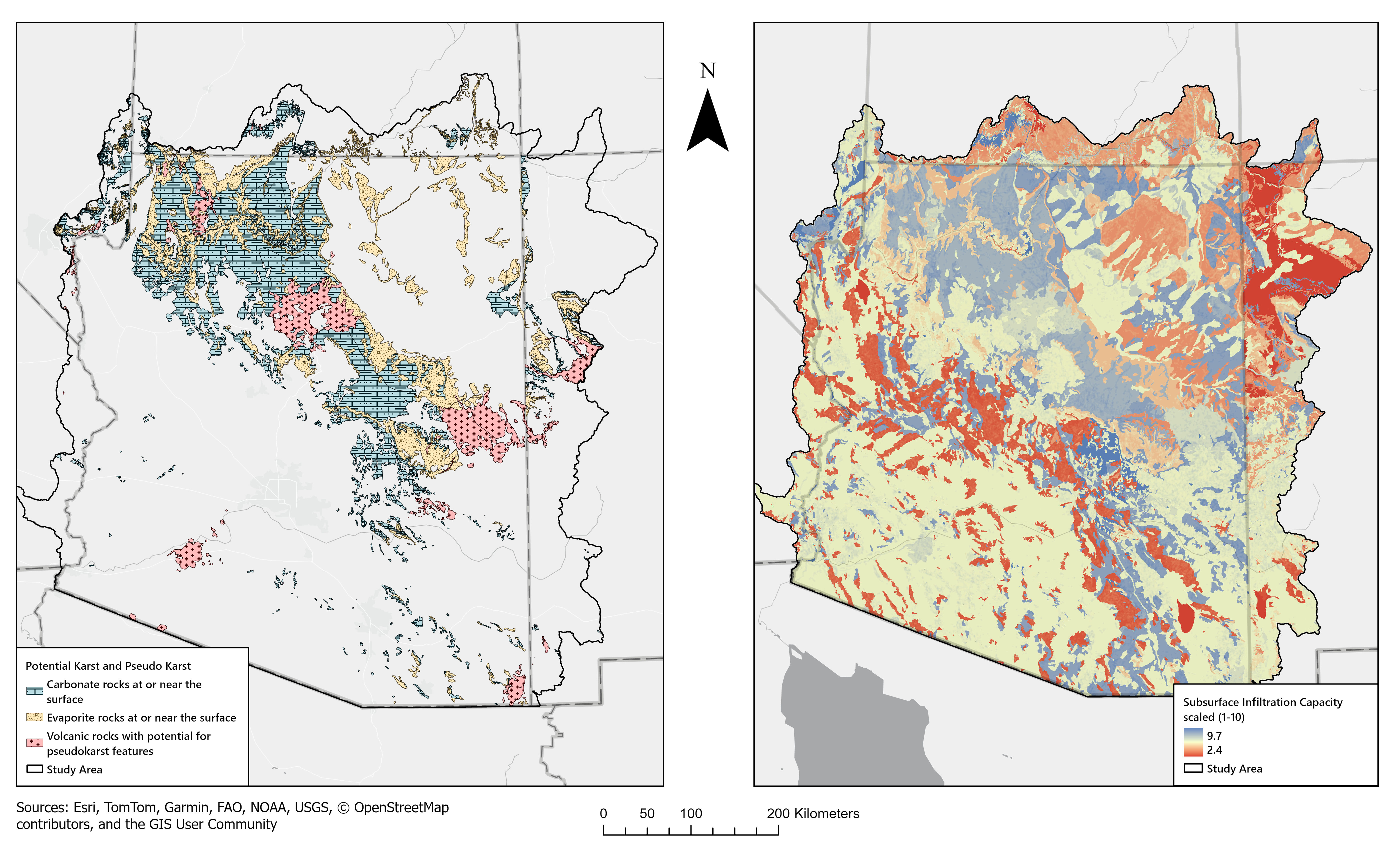
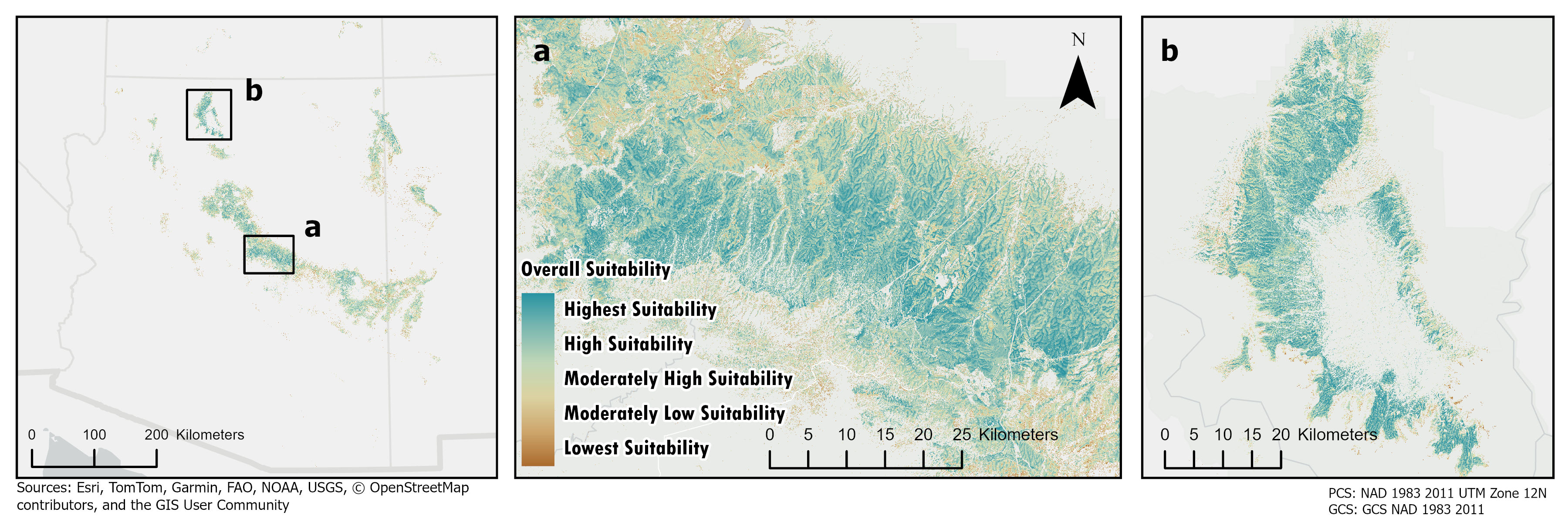
Toward Decision Support
- Combine layers (weights/MCDA) for Opportunistic Recharge Enhancement
- Prioritize corridors where:
- Sinkhole density is high and dolines are deep
- Lineament density/orientation aligns with recharge pathways
- Geology/soil support high permeability
- Flag conflicts: infrastructure, contamination sources, protected areas
 —
—